Dundas BRT
- Projects & Programs
- Dundas BRT
- What We're Building
- Dundas BRT - Preliminary Design
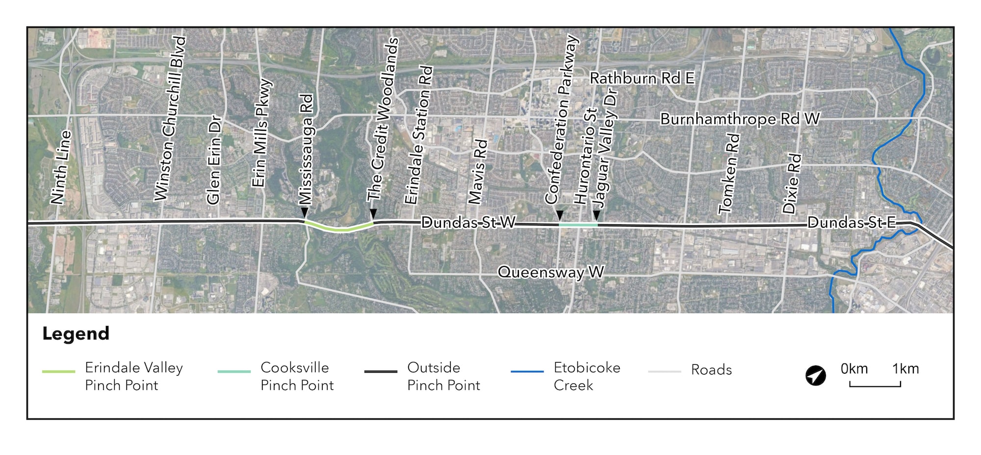
Dundas BRT Mississauga East map

Dundas BRT preliminary design
What is the preliminary design process?
The preliminary design process bridges the gap between the design concept and detailed design of a project.
During this time, the project team completes studies and analyses to compare and determine the technically preferred alternatives, leading to the 10% Preliminary Design of the project.
These preferred alternatives are then analyzed through the Preliminary Design Business Case (PDBC), which identifies risks and barriers that may impact the project, assists in refining the service plan for the corridor and establishes the preferred alternative which is then developed to a 30% Preliminary Design level.
Preliminary design progressed for the Mississauga BRT corridor
The BRT Corridor outside constrained areas, or pinch points, of the Mississauga locations are identified as:
- Etobicoke Creek to Jaguar Valley Drive – Mississauga East
- Confederation Parkway to The Credit Woodlands – Mississauga West
- Mississauga Road to Ninth Line – Mississauga West
The above areas have been developed to a 10% Preliminary Design level, based on designs presented in the Dundas Connects Master Plan and the Initial Business Case. The outcomes of this design are:
- Right-of-way (ROW) widened up to 42 m (from existing ROW of approximately 22 - 40 m in the Cooksville pinch point, and approximately 36 - 40m outside of the pinch point), requiring property acquisition with potential impacts to landscaping, entrances and parking, buildings and structures
- Dedicated median BRT lanes to improve transit speed and reliability
- Maintains two general purpose traffic lanes in each direction
- Enhanced active transportation
- Enhanced public realm, where possible
Proposed changes to the Mississauga right-of-way
Widening of the right-of-way (ROW) is required to allow for the addition of dedicated BRT lanes within the corridor, which will improve bus transit service operations and efficiency in the area.
Since the existing road right-of-way is less than the planned ROW of up to 42 m, additional property will be required in certain areas along Dundas Street to accommodate the widened corridor. This may impact structures, parking, entrances, landscaping, or other features.
Opportunities to mitigate potential impacts to properties, where possible, will be explored through:
- Optimization of the corridor alignment (e.g., widened to north, or south, or about existing centreline);
- Applying minimum standards for design elements such as lane widths and platform widths; and
- Reducing boulevard space that can be widened and enhanced through future land redevelopments.
Mississauga segment showing lanes
Preliminary Design – Design Progressed for Mississauga East
The Dundas Bus Rapid Transit (BRT) corridor outside constrained areas, or pinch points, in Mississauga East includes Etobicoke Creek to Jaguar Valley Drive.
Cross-section image showing lane widths.
The 10% Preliminary Design (PD) for this area has been further refined, based on feedback gathered from the public and stakeholders and additional technical studies undertaken by the Project Team. The outcomes of this design are:
- Right-of-way (ROW) widening up to 42m (from existing ROW of approximately 22 - 40m in the Cooksville pinch point, and approximately 36 - 40m outside of the pinch point), requiring property acquisition with potential impacts to landscaping, entrances and parking, buildings and structures.
- Corridor alignment optimized to minimize impacts to built and natural heritage features, as well as non-heritage properties.
- Corridor design optimized to minimize impacts to existing utilities, most notably the overhead hydro.
- Dedicated median BRT lanes to improve transit speed and reliability.
- Elimination of High Occupancy Vehicle lane and maintaining of two general purpose traffic lanes in each direction, with minimum widths (i.e., 3.35m through lanes) applied to eliminate or minimize property impacts.
- Enhanced active transportation, including dedicated protected cycling facilities.
- Enhanced public realm, where possible, with widened sidewalks, furniture (e.g., benches) and tree planning zones. Reductions in localized areas to eliminate or minimize property impacts, including a reduction in the furniture/pole zone (0.6m minimum) and sidewalks (1.5m minimum).
- Existing bridge and culvert replacements.
- Platform stop locations and geometry, including enhanced passenger protection with platform widths up to 4.2m where feasible.